Recovering Puget Sound is a complex, long-term process that involves many important partners working together on projects throughout the ecosystem.
One of those partners is the U.S. Environmental Protection Agency (EPA). Puget Sound is one of 28 estuaries of national significance in the country and part of the EPA’s National Estuary Program.
EPA supports recovery of Puget Sound through the National Estuary Program and the Puget Sound Geographic Program. EPA provides funding and support to ensure clean and safe water, protected and restored habitat, thriving species, and a vibrant quality of life for all.
In 2012, the Puget Sound Partnership’s Leadership Council established three initiatives to tackle multiple issues key to Puget Sound recovery: Stormwater, Habitat, and Shellfish.
To manage this effort, partners assembled into three Strategic Initiative Lead teams, charged with bringing people and ideas together to improve the water, habitat, and communities. The Action Agenda for Puget Sound guides the work of the Strategic Initiative teams.
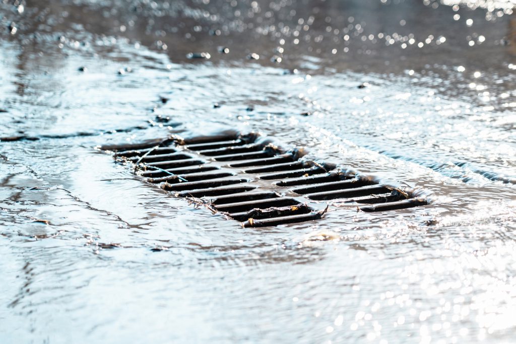
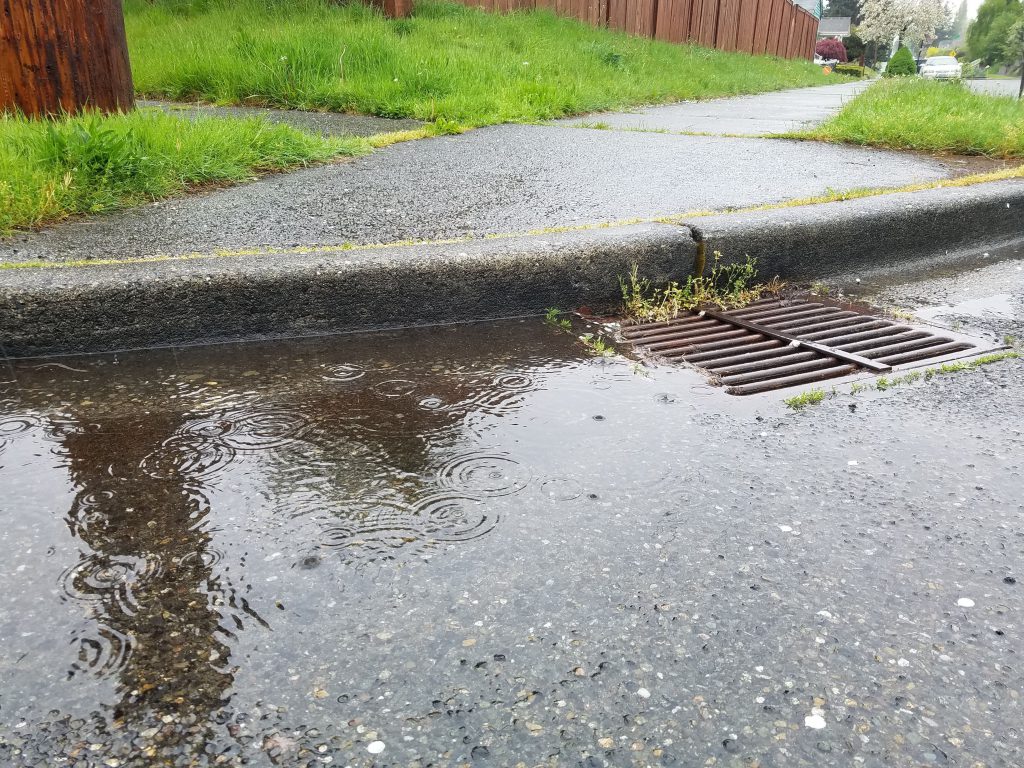
Rain running off buildings, roads, and other hard surfaces makes stormwater. Stormwater collects whatever chemicals or pollutants might be on those hard surfaces and flows into our waterways and Puget Sound. Stormwater pollution can:
- kill fish;
- damage stream water quality and habitat;
- carry excess manure and nutrients into the marine environment;
- create expensive pollution clean-up, the costs of which are often passed to residents; and
- pose public health risks from swimming, recreating, or eating from polluted water.
Preventing stormwater pollution protects what we care about, including recreation, food, and sustainability.
The Stormwater SIL recently awarded $1.6 million in Puget Sound Geographic Program funds to projects that help local governments plan for road retrofits to manage stormwater. This funding supports the following key goals:
- Plan for and prioritize locations for large capital projects that address priority stormwater source locations in the community.
- Control and lessen stormwater flow.
- Improve water quality.
- Control and lessen 6PPD (a chemical in tires that, when it reacts with ozone, creates 6PPD quinone, which is lethal to coho salmon).
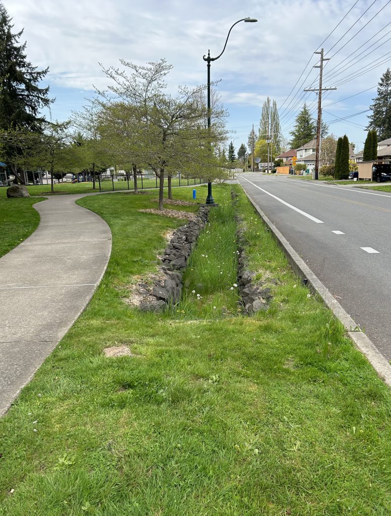
- Replace culverts.
“These transportation retrofit projects are giving local communities the tools and resources to target the most important areas for stormwater pollution and salmon recovery,” said Derek Day, Stormwater Strategic Initiative Lead, Washington State Department of Ecology. “We know that roads are one of the biggest sources of stormwater pollution, from heavy metals to toxic tire dust lethal to salmon. Just as WSDOT [Washington State Department of Transportation] has done at the state level, communities need the best science and the most up-to-date data to prioritize their transportation retrofit projects to deliver the most benefits for clean water for fish, people, and Puget Sound.”
Here are a few recently funded projects:
King County and University of Washington
Multi-criterion decision tool to address 6PPD quinone/tire-wear particles
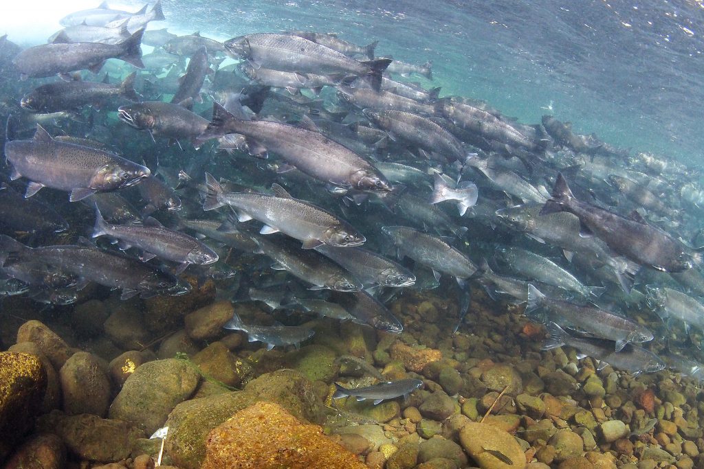
King County and University of Washington teams will create a mapping tool to identify road segments that are potential sources of toxic tire-wear pollutants. Stormwater brings these pollutants to streams, which adds 6PPD quinone (6PPD-Q)—a chemical that is lethal to coho salmon—to coho waters. 6PPD-Q causes coho salmon to die before spawning and has harmful effects on other salmon species.
King County will develop the mapping tool in collaboration with University of Washington scientists involved in 6PPD-Q research. The county will use data from the Washington State Department of Ecology’s (Ecology) Stormwater Work Group and collaborate with organizations doing similar work (Ecology, National Oceanic and Atmospheric Administration).
The project will use existing road and traffic data that can help predict the amount of tire-derived pollutants that will enter coho streams. The model will generate a heatmap predicting the highest concentrations of 6PPD and 6PPD-Q and provide a ranking of the pollution potential of road segments in connection with salmon habitat in nearby waterways. University of Washington researchers will check the accuracy of the heatmap by using stormwater sampling and analysis. The county will include the validated heatmap in a web-based tool for prioritizing stormwater retrofits.
The tool will help King County prioritize locations where stormwater treatment will have maximum benefit to salmon and waterways. The mapping tool will also be adaptable to other areas beyond King County and open to data from other partners.
Thurston Regional Planning Council
Thurston County road retrofit planning study
The Thurston Regional Planning Council will assist with a process to rank roadway retrofits and improve stormwater management in the South Puget Sound region. Project partners include Thurston County and the cities of Olympia, Tumwater, and Lacey.
The South Puget Sound region mostly has stormwater management systems that lack treatment and flow control and do not meet current regulations. The region’s population has grown, and projections show this trend will continue over the next 30 years. With this growth comes increased pressure on local waters (rivers, streams, wetlands, and Puget Sound) from heavier pollutant loads carried by roadway runoff. This runoff affects aquatic habitat, fish, shellfish, and other wildlife populations, public health, and human well-being. However, there isn’t enough staff capacity or regional stormwater planning resources to match these needs and challenges.
This project will better prepare local jurisdictions in the region for planning and ranking effective roadway and regional stormwater retrofit projects that will be funded and carried out as part of the greater Puget Sound recovery effort. The project’s ranking framework will use existing data that can be updated over time to help regional stormwater staff achieve the following:
- find roadway pollution ‘hotspots;’
- ensure projects include local salmon and ecosystem recovery priorities; and
- develop future treatment projects to minimize the amount of harmful toxins that enter local waters and Puget Sound.
Mason Conservation District and the City of Shelton
Mason Conservation District and the City of Shelton stormwater partnership
Mason Conservation District and the City of Shelton will develop a public road retrofit plan to find and map potential retrofit projects. The conservation district and the city will also work with community partners to create a ranked list of retrofit projects within the city. The top two to three projects will then advance through initial design. The city will include the retrofit plan in an updated stormwater comprehensive plan that will be developed in 2024.
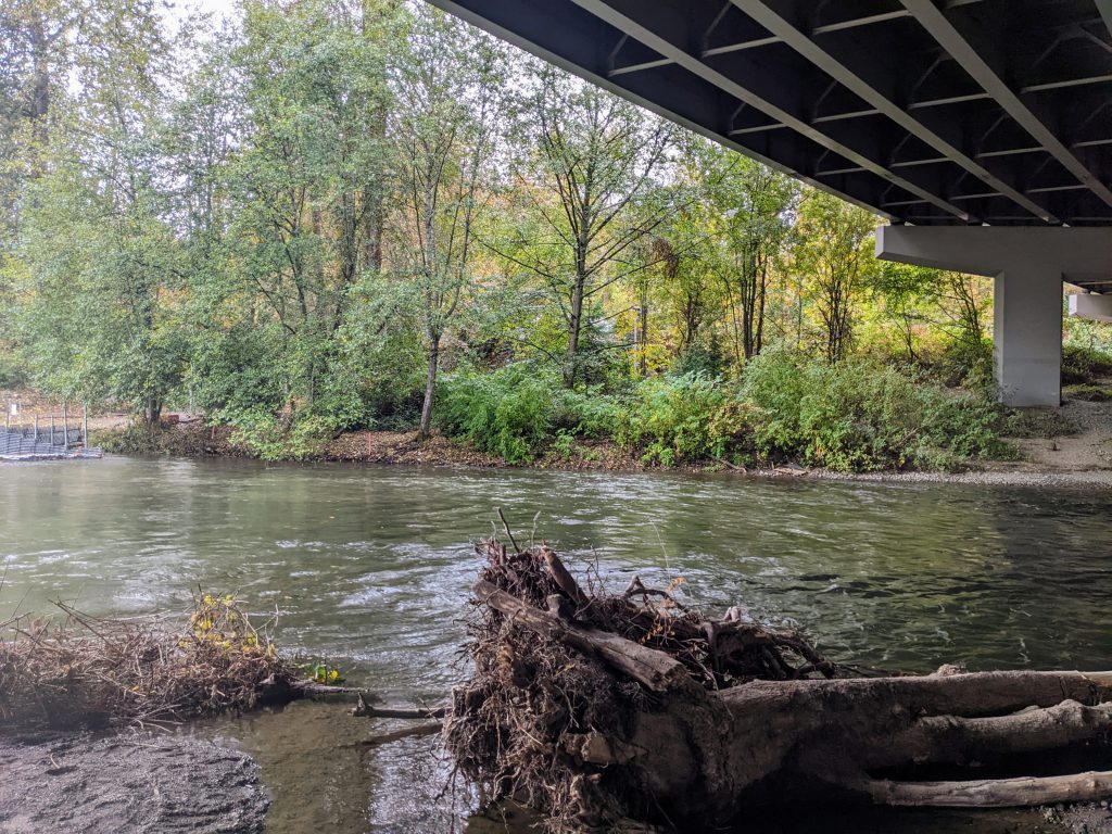
Stormwater runoff contains toxic pollutants and excess sediment that can enter rivers, streams, and bays. The polluted runoff reduces water quality and harms fish species. Coho salmon are especially affected by pollution from roadway runoff. Goldsborough Creek is the most productive coho system in southern Puget Sound. Goldsborough Creek and Shelton Creek—another salmon-bearing stream—run directly through Shelton, where there are direct stormwater discharge points (where stormwater runoff flows into water bodies). There have been many successful restoration efforts carried out in this watershed, but salmon are still at risk from stormwater runoff.
The Nature Conservancy
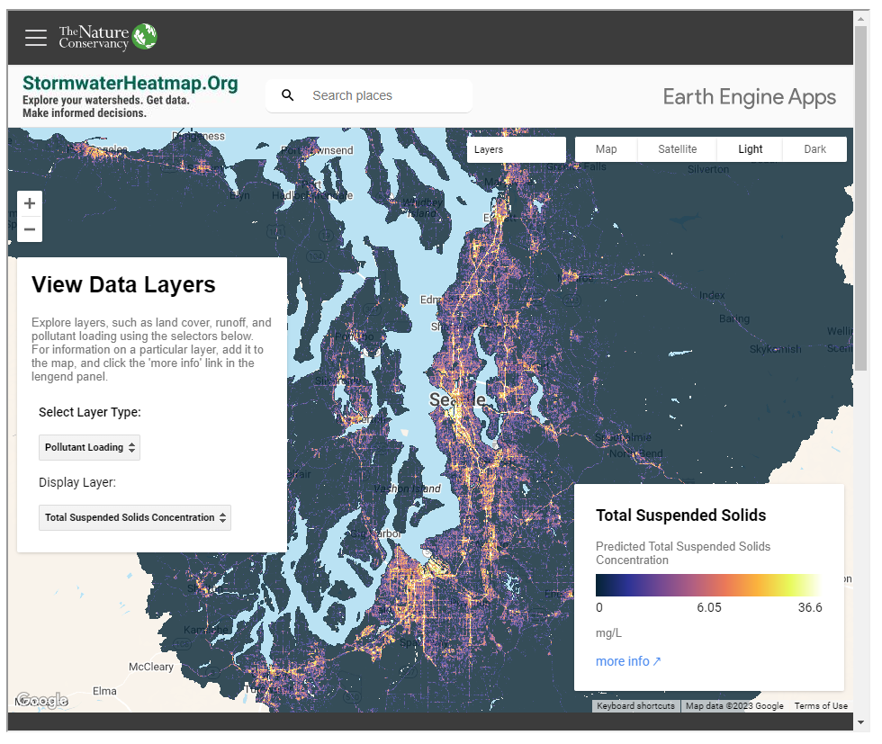
Puget Sound stormwater heat map version 2.0
As population and development growth continue in Western Washington, stormwater poses a big challenge. This is because stormwater from different sources is hard to track as it collects and concentrates pollution. Though effective solutions exist, the billion-dollar question remains: how much stormwater management does the region need and in what locations?
Local governments, utilities, and agencies spend public funds creating stormwater plans, leaving fewer resources to carry out those plans. This is especially true for smaller cities and towns without robust stormwater management departments. The Nature Conservancy learned about four major barriers to creating science-based management plans:
- acquiring data is difficult;
- modeling hydrology (the movement of water) is slow and requires large amounts of computing resources;
- pollution data isn’t detailed enough to inform decisions; and
- communicating with partners, rate payers, and regional leaders about planning choices is challenging.
The Nature Conservancy worked with many partners to deal with these problems by mapping runoff and pollution at a larger scale than was previously possible. The Stormwater Heatmap is a science-based tool designed to help:
- tell stories using compelling visuals;
- reduce planning costs; and
- take targeted action on runoff and pollution hotspots by making infrastructure improvements.
The Nature Conservancy launched version 1 of the Stormwater Heatmap in March 2022 to help deploy stormwater management projects more quickly and in more locations so that people and nature can thrive. The 2.0 update will refine the map and provide decisionmakers with more in-depth information by improving user accessibility, data validation, and technical documentation.
Future funding opportunities
This summer, the Stormwater SIL will release several requests for proposals for Puget Sound Geographic Program funding. These requests for proposals are related to freshwater quality, toxics in fish, and marine water quality. More information is available on the Stormwater SIL funding page.
“These proposals come from many in-depth discussions with our Advisory Team and a great community of expert practitioners about the areas of greatest need and opportunity to move the Action Agenda forward,” said Libby Gier, Stormwater Strategic Initiative lead, Washington State Department of Ecology. “We’re looking for those ideas that connect the dots from research to infrastructure to ecosystem recovery.”
